Here is a link for our full 12-day itinerary from Reykjavík.
We are on the tenth day of our journey and today we are going to the most remote place of the island.
If you are curious to know the beginning of our journey, here are the links:
- Day 1 and 2, the Golden Circle, click here 😊
- Day 3 and 4, from Hella to Höfn, South Iceland, click here 😊
- Day 5, De Höfn à Egilsstaði, click here 😊
- Day 6 and 7, from Egilsstaðir to Húsavík click here 😊
- Day 8 and 9, from Húsavík to Ísafjörður click here 😊
Best things to do in Iceland
Here we are in the heart of the matter — what to do when you are in Iceland?
Well, you are spoiled with choices, and that’s good. 😃 To help you pick, below you will find some places I visited and the activities I’ve tried. All you have to do is make your choice.
My personal opinion:
😍 Do not miss
😃 Go if you have time
😐 Not very interesting
😭 Unfortunately, we couldn’t do it
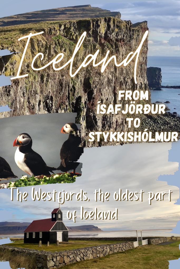
Day 10: From Ísafjörður to Stykkishólmur – 351 km
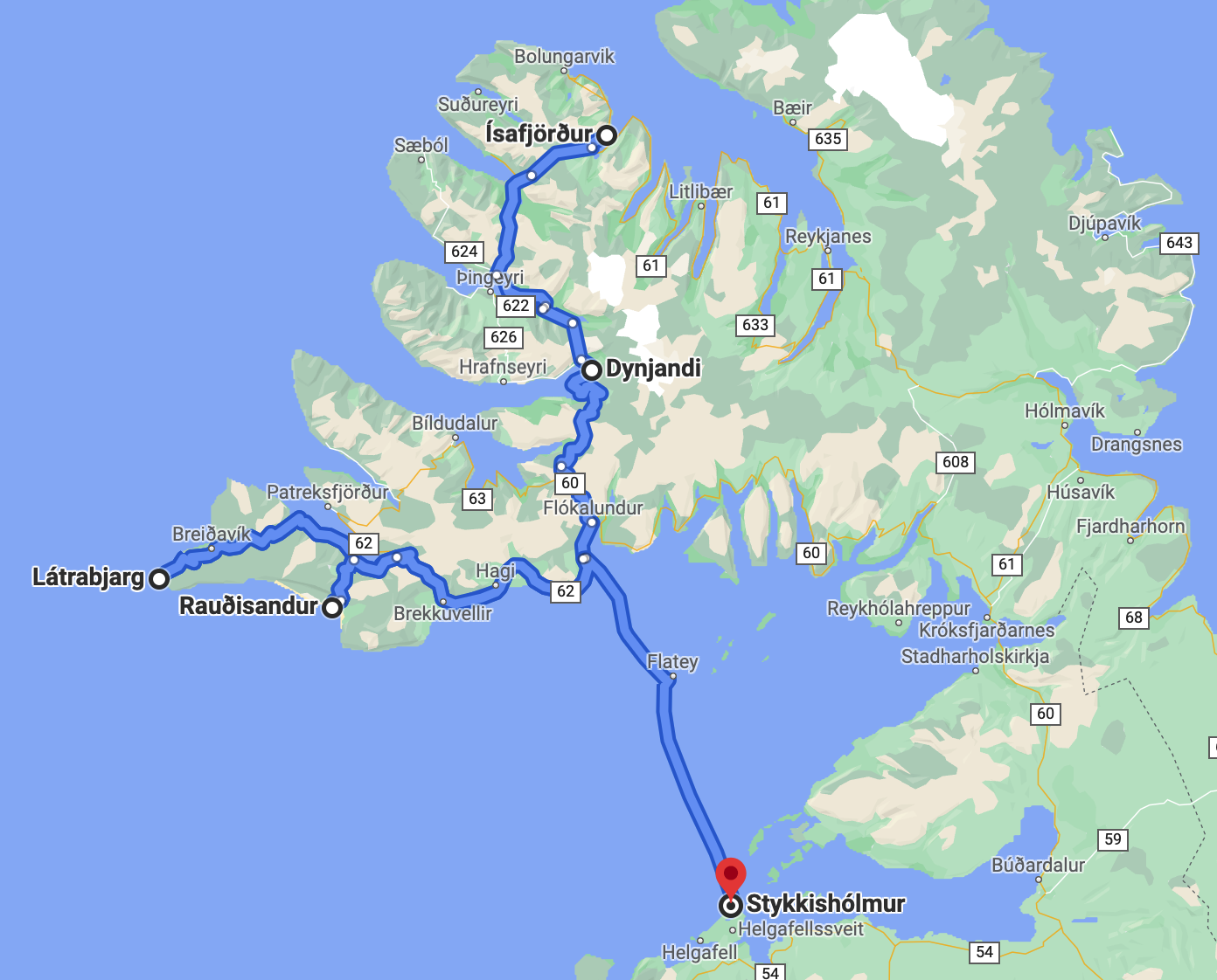
The stops we planned for the day
- Dynjandi waterfall
- Distance from Ísafjörður 53 km – 44 min
- Visiting time 1 hour
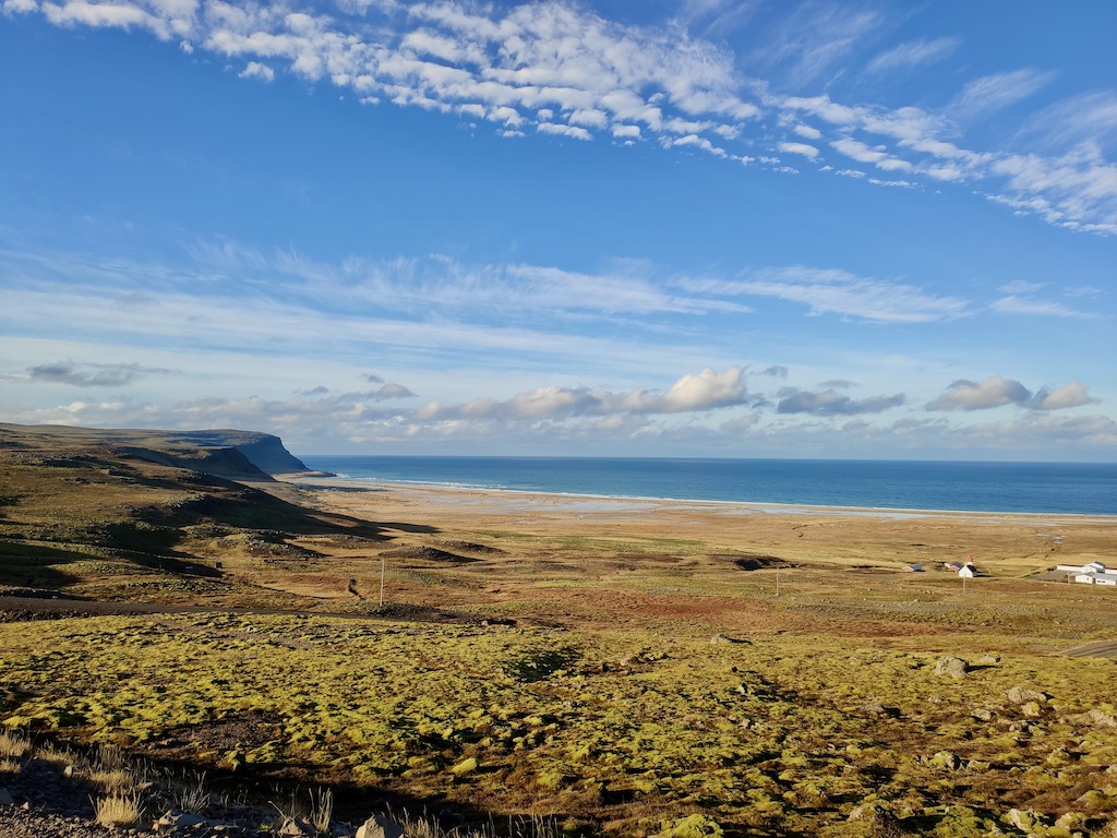
- Látrabjarg, Iceland cliffs, and its bird Colony
- Distance from Dynjandi 129 km – 2h20
- Visiting time 1 hour
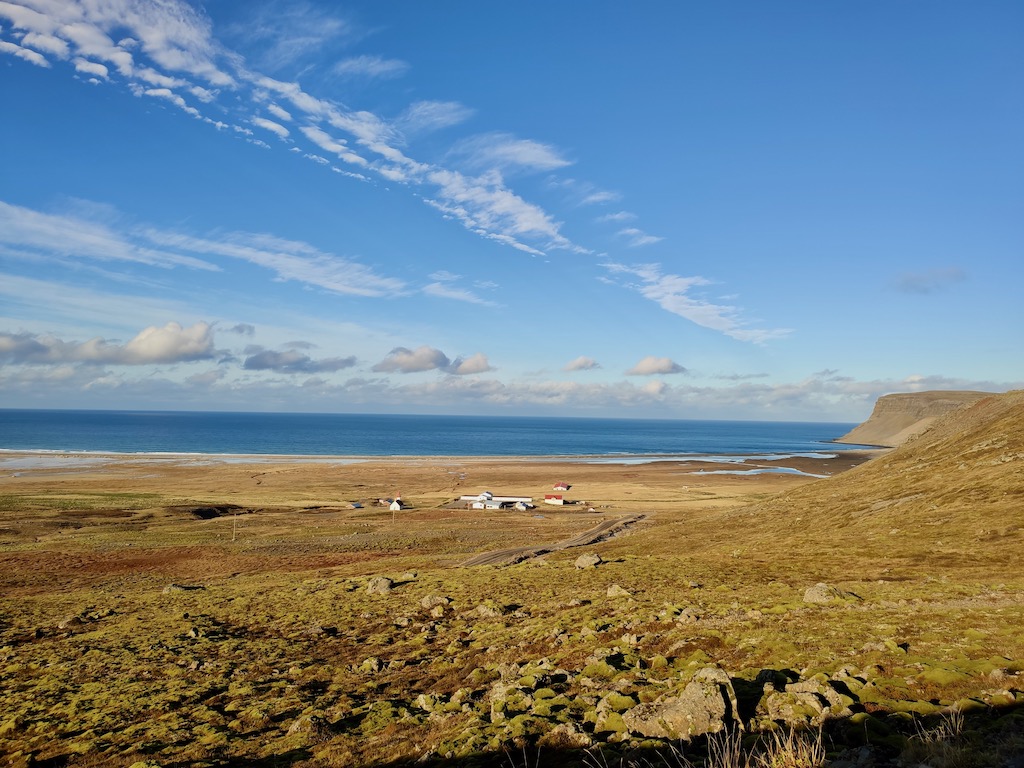
- Rauðisandur Beach, the red beach
- Distance from Látrabjarg 50 km – 1h10
- Visiting time 30 min
- Stykkishólmur (en ferry)
- Distance from Rauðisandur 119 km – 4h00
- Stop for the night
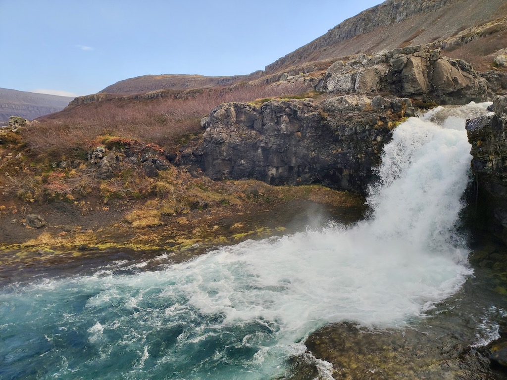
😍 Dynjandi waterfall
The Westfjords are the oldest part of Iceland. They were born from a series of volcanic eruptions about 15 million years ago. After the following Ice Age, the glacier’s advancement carved deep valleys and fjords into the landscape, leaving behind rock layers of varying degrees of hardness. It is these layers that form the terraces of the Dynjandi waterfall.
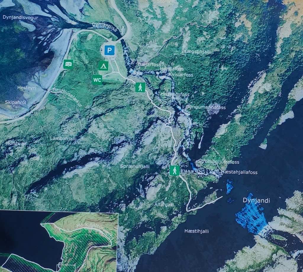
The river originates from several lakes in the Dynjandisheidi area, Kálfeyrarfoss, a plateau 7 km further up the road. There is a point of view that you have to watch out for and that we unfortunately missed. If you go there, please send me a photo!
The short climb from the car park to Dynjandi waterfall takes us along a string of smaller waterfalls.


When we got back on the road, we arrived at the top of a pass greeted by this giant statue, Kleifabúi.
Kleifabúi Statue
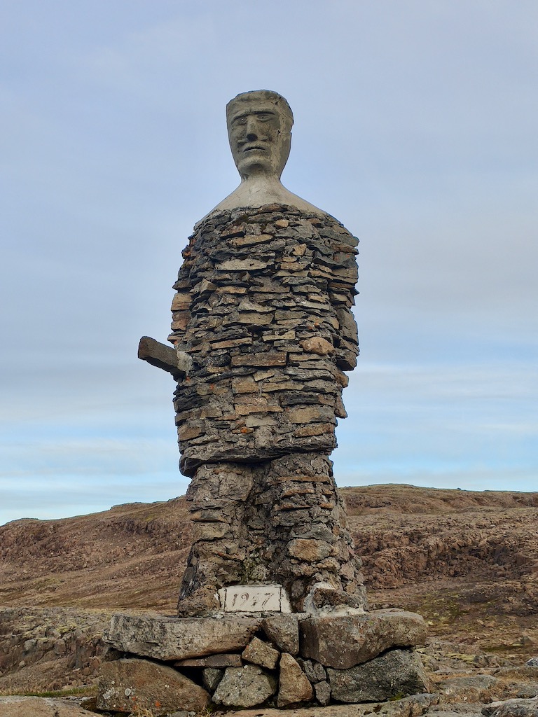
It was erected in 1947 by the workers who built the road with only hand tools. In other words, it was a titanic project.
According to history, they decided to create this statue when they arrived at this pass — a giant guardian watching over the silent wildlands.
The then head of the public works company even wrote a few verses against him.
Búi stands high on the rock,
Offering its steady mouth,
And look at the high and silent moors.
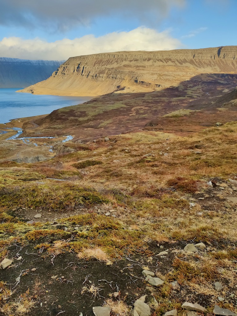
We completed our route to reach the Látrabjarg cliff and its colony of birds. Suffice to say that we did not meet many people, one or two cars at most.
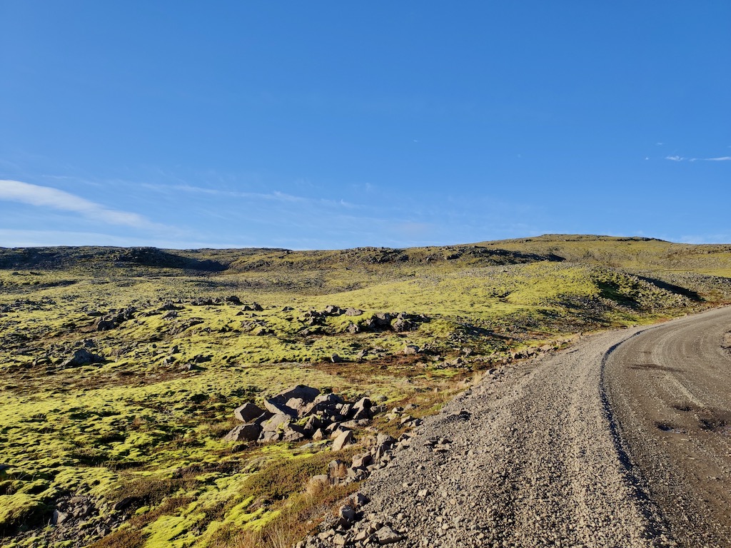
On our way, we crossed landscapes with breathtaking colors!

Summer is the season for bird watching, so we knew the cliff was going to be empty. It’s a shame because I would have liked to approach puffins, these little colorful birds, which have become the image of Iceland.
You can find them in all souvenir shops. Maybe I’ll fall for a little stuffed one.
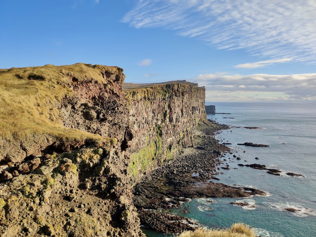
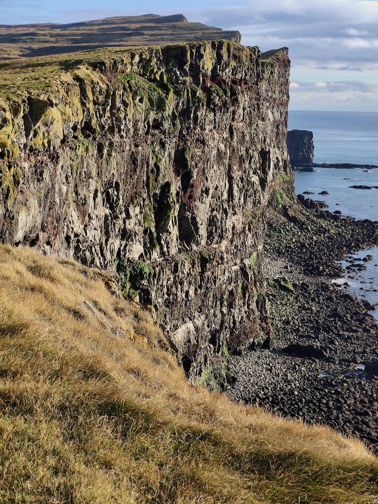
😍 Látrabjarg cliff and its bird colony
Hunting birds and collecting their eggs
From the beginning of the colonization of Iceland until 1926, the collection of eggs and nesting bird hunting has always been an important source of food. In some years, up to 36,000 birds could be caught.
While the egg harvest took place in the spring, the inhabitants hunted during the summer, when the birds were more docile.
There were two methods to reach the cliff. The first, which consisted of abseiling, was mainly used on its western part, where it falls directly into the ocean. The second, meanwhile, was to climb from the beach.
Unfortunately, after several non-fatal accidents, it was the death of two men that put an end to this practice.
But to perpetuate this traditional know-how, members of the local rescue teams still rappel down a cliff a little further to collect eggs.
Látrabjarg cliff

It is the largest in Europe and one of the most spectacular seabird cliffs in the world. It is 441 m high and 14 km long.
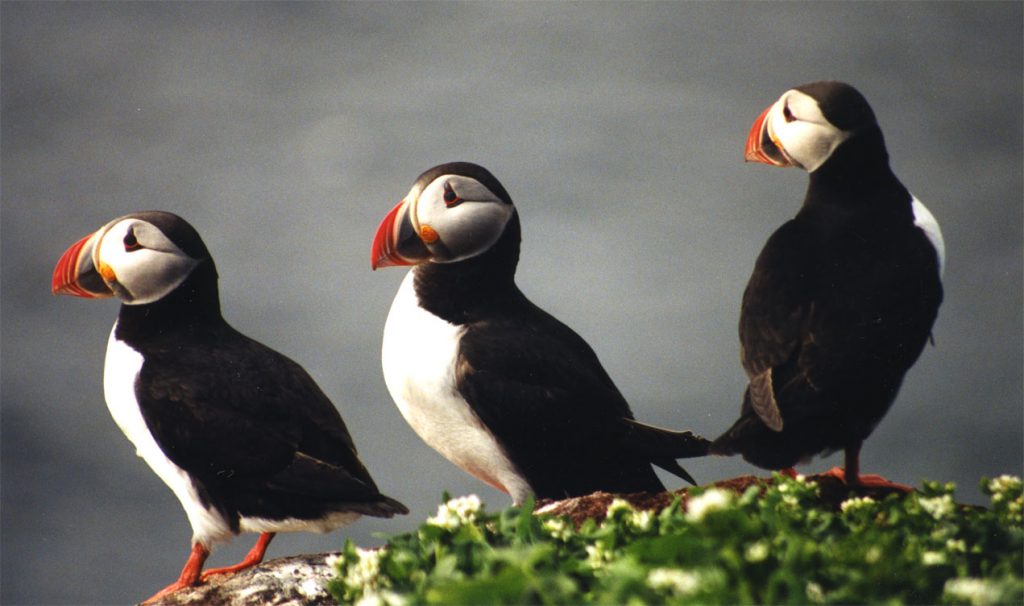
Millions of seabirds come here to nest and raise their chicks. The puffin — the best known in the country — is recognizable thanks to its rounded silhouette, vertical gait, and eyes circled in red and underlined by a thin black eyebrow.
Puffins
But they don’t always wear those colors. These gray birds transform as the mating season approaches when they are at sea. And that’s how we know them. They then take on a brighter hue. Their webbed feet change from pale yellow to orange, and their slightly hooked beaks thicken and gain a dark blue base surrounded by yellow and a red tip.
The all-gray chicks will have to wait until they are three years old to flaunt these magnificent colors.
Their wings are small but powerful, allowing them to fly extremely close to the water and swim — they don’t use their legs to move forward.
Another characteristic of the puffin is that they dig a tunnel in the cliff, which can reach up to three meters and in which the females lay only one egg each per year.
Those numerous holes in the cliff weaken it and make it dangerous to walk too close to the edge.
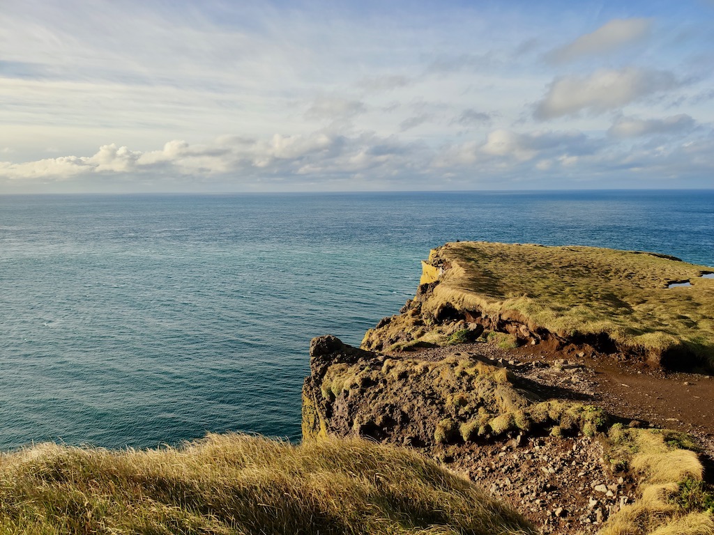
We set off for a walk along the coast, taking care not to get too close to the edge. Despite the sun shining, the icy wind got the better of our motivation, and we turned back. On the way back, I recalled what I read on a brochure — these millions of birds spending their summers here. It seems that they are used to the presence of people; you can approach and photograph them easily.
But the most chaotic thing must be the noise when they are continuously coming and going in the sky. The vibe must feel so different.
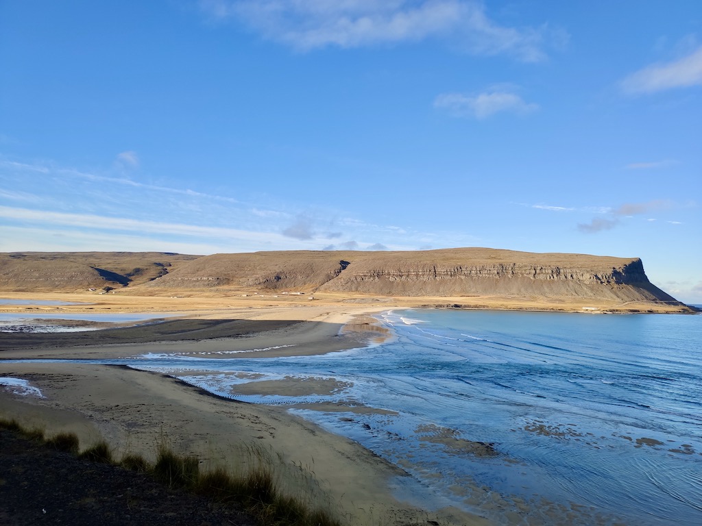
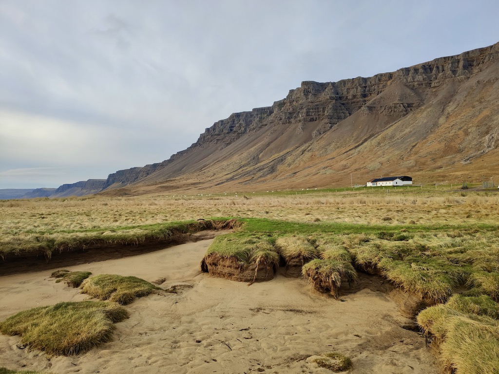
We left by the same coastal road for Rauðisandur, a red beach full of promise.
😍 Rauðisandur Beach, the red beach
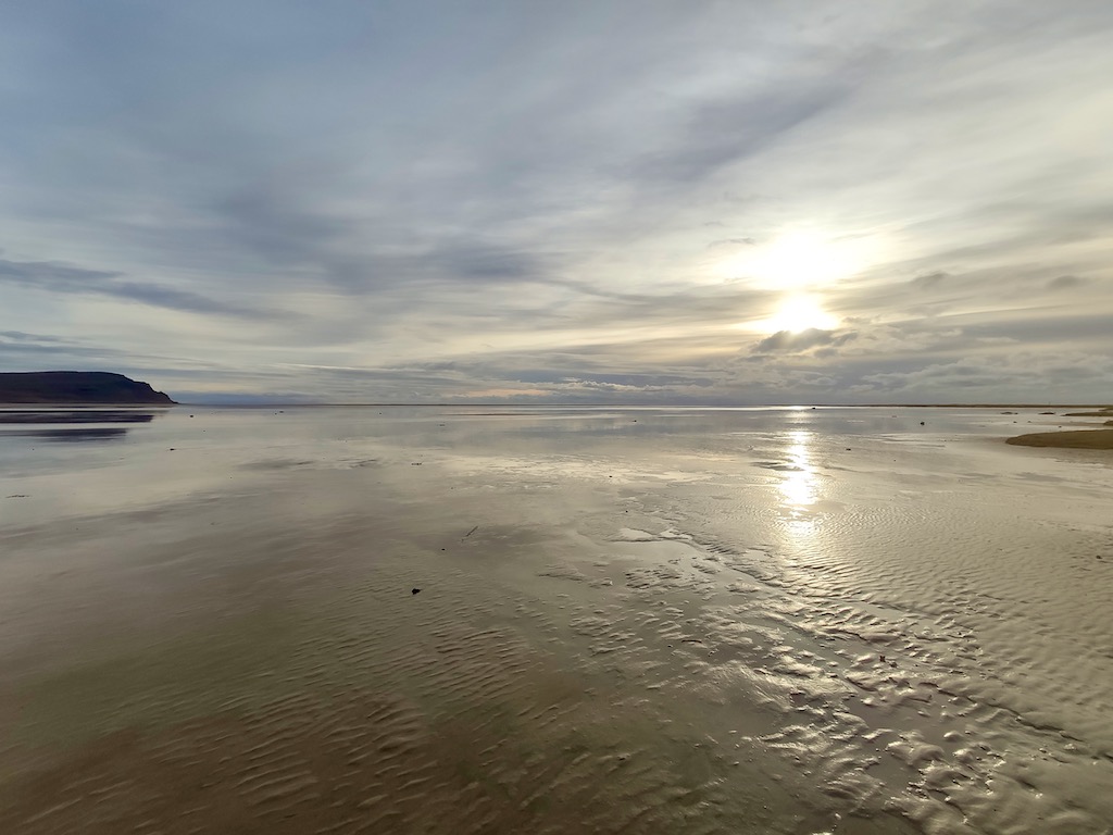
After discovering a completely black beach, here is a red one. Or what people call a red beach. Maybe during the summer, the sand looks more this color, but the day we went I found it to be rather ochre. But still, what a beach!
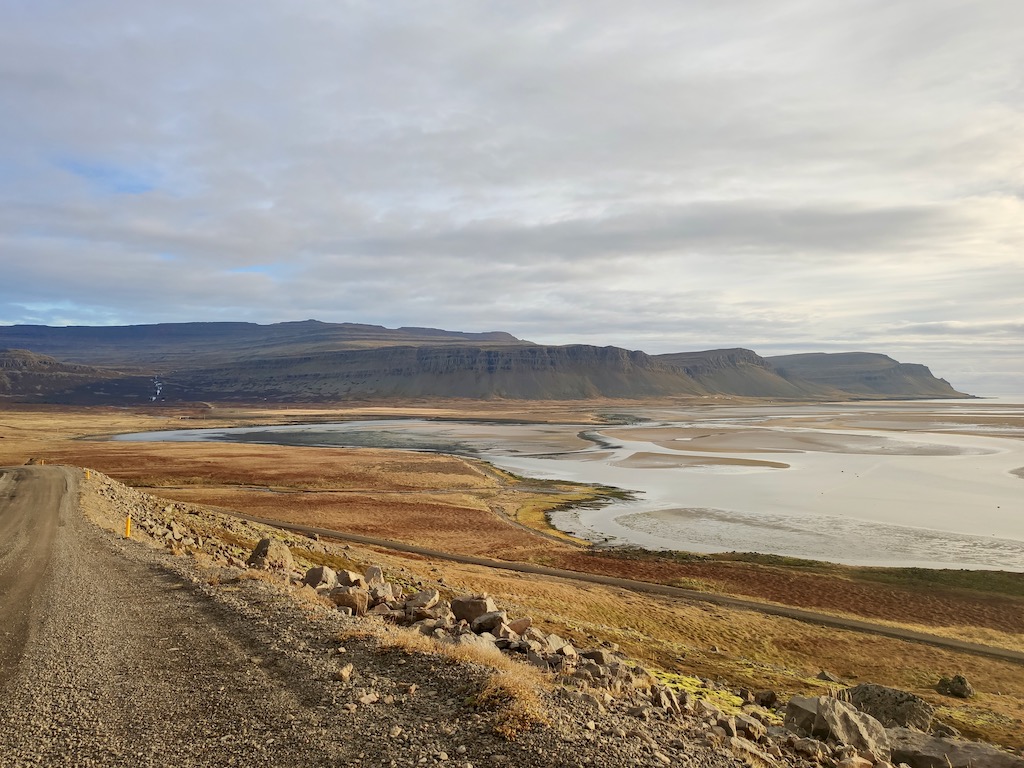
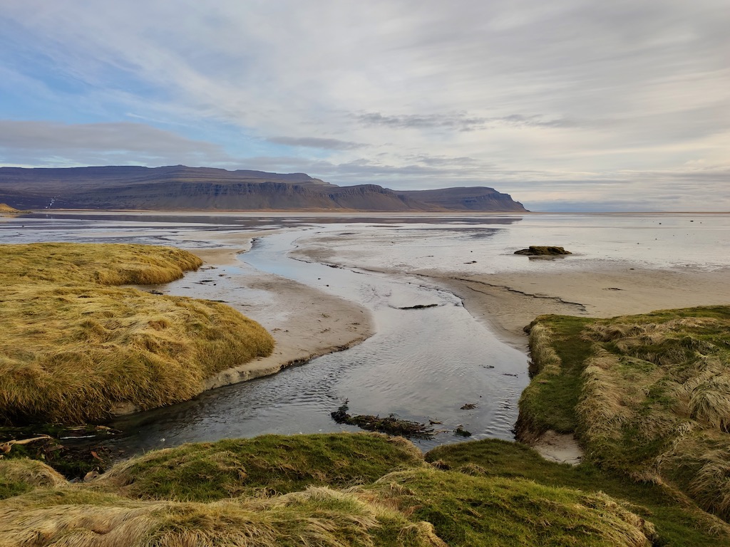
It was just amazing to see it around a bend. It is an immense expanse that stretches for kilometers along the coast and disappears into infinity at low tide.

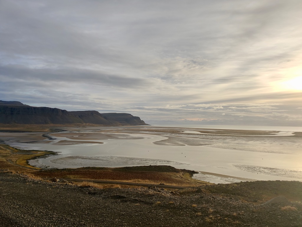
For information, you can find walks along the coast — the Lambavatn-Efra (10 km – 3 h 30) and Melanes (3.5 km – 45 min) hikes — if you want to walk more than a few hundred meters in the sand.
To end our day, we decided to take the ferry to Stykkishólmur. The crossing takes 4 hours. It’s not necessarily quicker than taking the road, but it’s definitely safer and more relaxing. And what’s more, it was new for us!
Luck is still on our side as it was a calm crossing that brought us to our cozy little nest of the night.
😐 The little town of Stykkishólmur
It is a charming tourist town on the edge of the ocean, whose relaxing atmosphere seduces the inhabitants of Reykjavik during the summer season. We only stayed there one night and didn’t take the time to visit it. I admit that we focused on nature and wild spaces during our stay and fled the cities.
Stykkisholmur in a nutshell
Stykkisholmur has long attracted settlers for its natural harbor and access to the fertile fishing grounds of Breiðafjörður. The first proper development of the city occurred in 1550, with the creation of a trading post. These were rare in Iceland due to the dangers and distances involved in traveling across the Atlantic. But Stykkisholmur Harbor made it possible. Moreover, its primary sector remained the fishing industry.
Its growth continued in 1602 with the Danish commercial monopoly, which lasted until the 18th Century. This trade impoverished many Icelanders but contributed to the enrichment of towns along the peninsula.
As a result, even if some Icelanders harbor ill feelings against Denmark, this is not the case with Stykkisholmur. The city has always maintained good ties with this country. Thus, every third weekend of August since 1994, Stykkisholmur organizes a festival, the “Danish Days” to celebrate these relations.
Final word
Everything is so beautiful and grand. But we are starting to get closer to Reykjavik, which is the end of our adventure. We enjoy these magnificent views all the more that we know that we will soon leave them.
Before coming, I didn’t think that Iceland had so much variety of landscapes. Volcanoes, glaciers, and geysers were the only things I imagined finding here. But it offers so much more.
I can’t wait for tomorrow. We will explore the Snæfellsjökull National Park, and it is said that we will find there the beauty and diversity of Iceland all in one place.
My eyes are already sparkling.